

Project Maps

Two people reviewing a large map or architectural plan on a table, one pointing at the map with a pen.

Use the below maps to understand the location of the Coles Wind project. With the interactive GIS map, you can search for your address or other points of interest to identify where those locations are in relation to the project.

Interactive GIS Map

Road Use Agreement Map
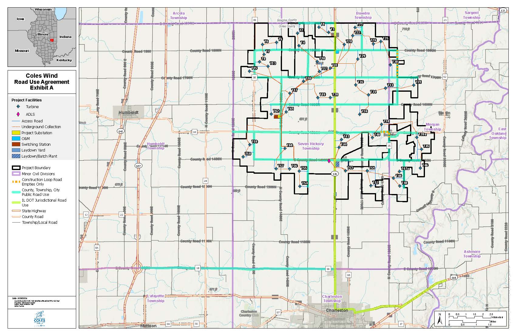
Map of Coles Wind Road Use Agreement Exhibit A showing project facilities including turbines, ADLS, access roads, underground collection, project substation, O&M, switching station, laydown yard, and laydown/batch plant within project boundary outlined in black. Colored lines indicate minor civil divisions, construction loop roads, public road use, IL DOT jurisdictional road use, state highway, county road, and township/local road. Townships of Arcola, Humboldt, Seven Hickory, Morgan, East Oakland, Ashmore, Charleston, and Lafayette are labeled. City of Charleston is marked. Map includes scale, north arrow, and inset showing location in Illinois with surrounding states Iowa, Missouri, Indiana, Kentucky, and Wisconsin.